I didn’t sleep too well, although I was warm enough without a sleeping bag (just my bivvy bag, sleeping bag liner, a jumper and track suit trousers). One of the main problems was the wind got up in the night, and with no proper closures on my tarp, it kept inflating and flapping around me. A few extra twists to the tapes that were attached to pegs, and trying to clench the door together more, helped quite a bit. It must have because when I woke up properly, my shelter was still standing. I quickly packed up, which took less than 15 minutes, and I was ready for my 7:30 breakfast. I sat with a chap who I chatted with last night, he had walked the Camino twice and done lots of walking in the UK so it was good exchanging notes. The cooked breakfast was good, camping on a YHA site, really does lift the camping experience to another level with all the extras.

I headed off before 8:30, although I did need to walk back up the hill to the hostel for my poles, which I had carefully put in the entrance hall so I didn’t forget them. Beer is a nice village, with a stream running in channels along the main road. There were lots of little businesses, but I can’t imagine it getting really busy. My main observation was how little effort had been made into using the name Beer in their businesses. A pub called the “Barrel of Beer” was the only one, together with the headland overlooking the town was magnificently named “Beer Head”. Where were the small businesses, such as “Beer Mats & Carpets”, or “Beer Glass” for glazing or glass ornaments, this could also be used for an optician, but I feel “Beer Goggles” would be more appropriate. Feel free to use the comments section for any I’ve missed!


I knew it was going to be a hard day today as I had planned a route with over 1,300 metres of climbing. I was slightly encouraged by the chap in the hostel saying the worst climbing was to Sidmouth and after that just one big climb before dropping to Budleigh Salerton. To add to that, the young guy running the YHA, said that I was being over ambitious trying to get to Exmouth. So I wasn’t surprised by the first big hill out of Beer, it was the first slog of the day, with great views over the bay.


The elevation profile, at the end of this blog, shows the nature of the day. Slowly climbing up from sea level to 150+ metres, then slowly descending back to sea level. There was hardly any flat, and no too much shade from the sun which was getting hot quite early. The first drop to sea level was at Branscombe. I think this went down to the beach sooner than my map due to a footpath closure. I don’t know why the footpath closure maps are so hard to read, I have to really study them to get my bearings. Just having a “Vous et ici” pointer on the map would really help. (“You are here” for those not fluent in french).

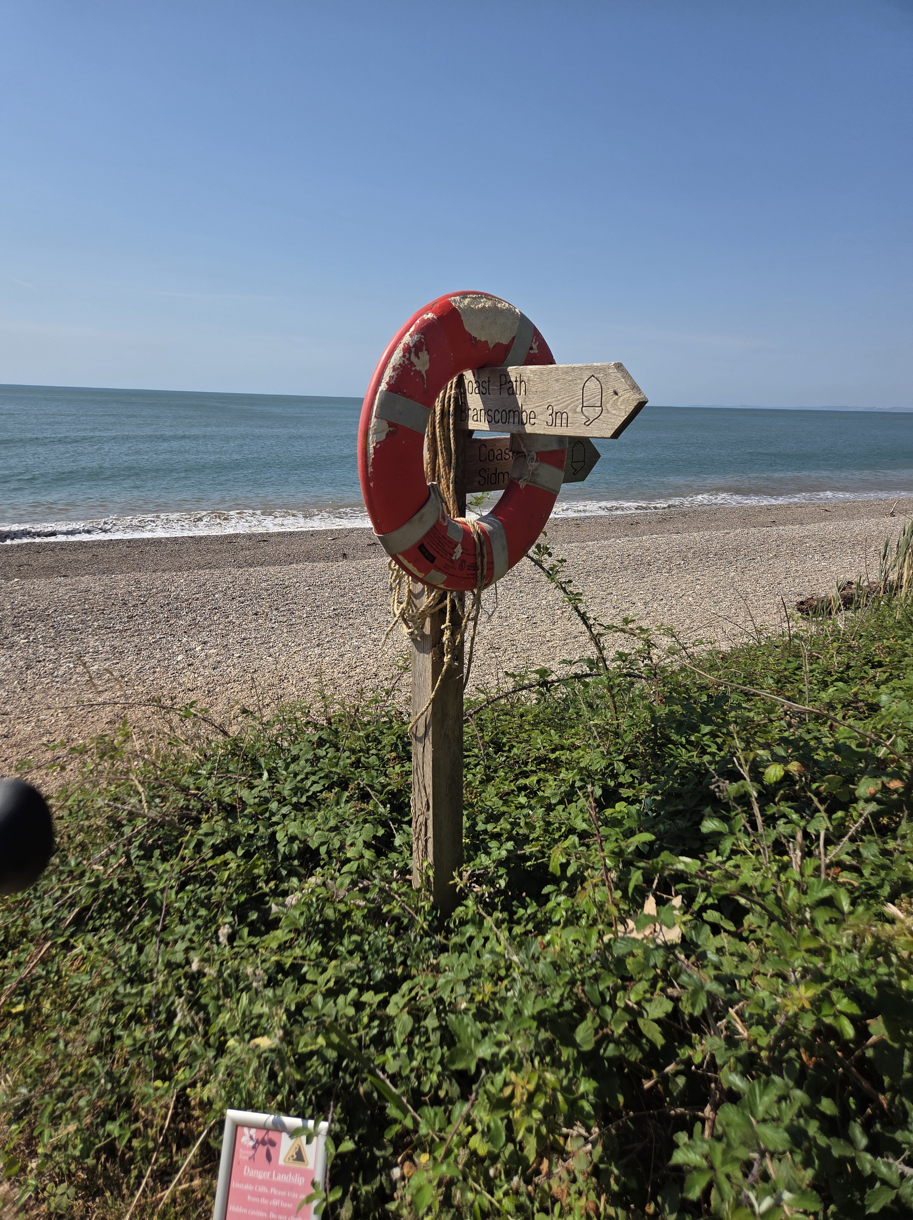
It was a long drag along the beach, but it did allow a good look at the famous Branscombe beach huts, which unlike most beach huts allow overnight stays. There were also alsorts of scattered huts and caravans on the cliff above. I think they are renowned for being very expensive, but by the look of things, some people’s money may have gone down the drain, or rather off the cliff edge. There is a lot of erosion along this part of the coast.


There is a cafe at Branscombe, which I shunned as my breakfast was still working. I didn’t have any spare food (apart from a couple of cereal bars) but felt I should be able to get to Sidmouth with my current fueling. The most remarkable part of this walk was walking through almost a mist of butterflies. I’ve now worked out, that if you want to photograph butterflies, it is best to catch them just before they have had breakfast, and spend longer with their wings open. I think they may be warming up after the night, but it makes them (slightly) easier to photograph. I think I will dedicate a day to just sitting in a field to try to get as many butterfly photos as I can. That seems like a nice way to spend a day.


Moving forward there wasn’t anything else to report on, just hills and the occasional visit to a beach, usually at the mouth of a stream. The hills just got harder, where there were steps they were either massive with each needing a huge effort to get up, or a massive impact as you stepped down, or small and uneven meaning picking a route through or around them. It was two walking pole territory. However, the views were superb and there were a few other walkers coming the other way. Most had the look of being coast path(ers), or more specifically South West Coast Path(ers), carrying reasonably big packs. It was nice to see they were predominantly women, and often solo.

The seaside town of Sidmouth started to come into view, just emerging from behind, what I hoped was the last headland to climb over. This one was a real struggle, towards the top I had to attack it at one step at a time, with a rest in between each step. It seemed a bit desperate. Looking at the Strava plot of distance vs time, I am practically stationary. It got me pondering as to whether the distances I had measured, and planned, were just horizontal distances or took the length of the ground into account. It would explain why I had happily maintained 5 km/hr across Kent, but had dropped to below 3 km/hr today. It might not all be down to my lack of fitness, the topography and heat, it maybe that geometry is conspiring against me as well. I definitely need to re calibrate my planning for Devon.

When I walked into Sidmouth, I think I had probably already made the decision to finish here, but I did fill up my water bottles and find somewhere for lunch. I ordered a nice Devon crab sandwich, and a bitter shandy, which proved I still had thoughts of continuing. During lunch, I started to look at maps, which said it was around 12 km to Budleigh Salterton, and a further 8 km, or so, to Exmouth (my planned finish at a railway station). My main concern was that that my watch showed I had only climbed 600 metres, and the Ordnance Survey had calculated the total for the day to be over 1,300 m. Therefore, I hadn’t even done half the climbing. I had been trusting in the Youth hostel guy saying most of the hills were before Sidmouth. It just wasn’t true. Looking at transport, there was a frequent direct bus to the railway from Sidmouth, while from Budleigh Salterton I would need to catch two buses with an infrequent connection. With regard to completing the planned route was that I needed to get to Exmouth by 8 pm to get home tonight (well by 1:10 am tomorrow), and I have a commitment tomorrow.


After the bitter shandy, I had a pint of Otter Ale, and the decision was made. Its better to walk a short day, rather than get caught up in a massive miscalculation of how hard the next section of the walk might be, or how hot the sun may be. I had a wander through town to the bus stop, and after a short wait and I got the prime seat at the front of the top deck on my way to Honiton Station.


Apologies for the late publishing of the blog. I blame Flickr, the site I use to backup and host my photographs. It is a really good solution, and it save having to get more and more WordPress storage as this blog grows. However, Flickr has changed its mobile app for the first time in ages and automatic uploads of my photos seems to have failed. I’d still recommend Flickr for backing up your photographs, but I need to get the app working properly for my usage (uploading photos on the go, and providing links to this WordPress site),


Vous *êtes* ici
LikeLike
Touché 🤣
LikeLike