Once again it was hard to decide whether to walk today. It was raining at home (although the apps were saying snow showers), but it was predicted to be dry in London until the evening. I headed out for a slightly later train than last week, hoping to get a seat and despite a train delay I sat all the way to London Bridge. Last week I had been planning (rather naively) to walk 30 km which would take more than six hours, and dusk was just after 5 pm. Today, I’m only planning on around 20 km, so should have more time. The days are getting longer, and sunset tonight is at 17:20, and about 12 mins later each week, which doesn’t sound much but is about an hour each month. From London Bridge, I jumped on the tube to North Greenwich. It does seem strange getting an Underground train to go for a walk, but I expect many Londoners must do it.

I made a quick exit from the station and headed straight to the river. I did consider popping into the Dome for the toilets, but couldn’t face the walk all around the inside. I walked right under the London Cloud cable car (and got a few extra pictures for one of my readers who didn’t know it existed).

I had seen one or two pieces of public art, which I had considered photographing, but thought if I did I’d be doing it all day. Then I spotted something that needed to be photographed. Damien Hirst’s “Demon with Bowl” or the “Massive Headless Giant” would be more accurate. Its just in the middle of a small park on Greenwich Peninsular. I have seen it before in a Hirst exhibition in Venice, where the giant was the center piece inside a building. At the time , I could not comprehend how they had got it into Venice (with no roads), never mind inside a building! At the time, I found a timelapse film showing the construction as I found it hard to believe it was more than one bit – quite amazing, unlike the rest of the exhibition!


The Thames Path continued past lots of new apartments, generally on a river wall. It was boring walking, but there was plenty to look at with the occasional excitement, like a yacht club so close to Central London. There were some sailors coming ashore, in full drysuits and life jackets, into an awaiting Uber. The driver didn’t seem too keen to pick them up.

For the next section, the path went through a narrow alley through a very industrial area. There were huge piles of aggregate, which didn’t look too safe and the path went under numerous conveyor belt systems used for unloading the ships on the river.

The Thames Barrier was looming, and much to my surprise there was a really good view of it from the path. I don’t think I’ve been up this close to it before, and it does look good (and a marvel of engineering and foresightedness [Joyce – that definitelyis a word!]). The Barrier has only operated in anger a few times (its actually 221 which surprises me), but must have saved so much damage and potentially loss off life. I was hoping that the Thames Barrier Cafe would be open, unfortunately it wasn’t really evident, with what looked like a business meeting being held in the most likely place.


The path headed inland and rather fortunately (almost) passed a McDonald’s. I’d only walked 5 km but it was a cold day (gloves needed all day) so a coffee and small burger as an early lunch, seemed appropriate. There was a “Waymo” car charging in the car park. Initially I thought it was for taking Google Street view pictures, due to the fast rotating camera on the roof. I looked it up, and I think it is a self driving car. It’s certainly loaded up with cameras and sensors all over it. There was a “driver”, but as it was parked up and they were eating a McDonald’s, I can’t comment on how well the car drove. [It looks like they are running trials before a completely autonomous taxi is introduced to London!]


The main feature of the path after the Thames Barrier was it was either on top of a massive sea wall, or at the bottom of a massive sea wall. If it was the latter and you were on the landward side, you had no view at all. It really shows the protection that the Barrier gives London as without it, I suspect these walls would be needed right into the centre. There were plenty of small disused docks which help retain the history of the area, despite extensive new developments.


The next major landmark was the Woolwich Ferry which was surprisingly busy. I thought it was only really retained to take heavy freight that was too dangerous to go through the Dartford Tunnel, or drive through Central London. Clearly not as there was big queue of ordinary cars as well as a few HGVs.


After Woolwich, I got back onto the official England Coast Path. I think it crosses the Thames here in a foot tunnel. I saw signs to the tunnel but no evidence of it. I think my purist approach of crossing by the first fixed bridge is safest approach, even using Tower Bridge is a bit dodgy! I then came to Woolwich Arsenal, this area has a long history of developing and producing munitions dating back to 1670, and being used right through to 1967. Seems like quite a dangerous thing to have so close to London!. There are an amazing array of old warehouses, factories and office buildings, all repurposed into swanky houses and apartments. A rather impressive sculpture, an array of cast iron moulds of men – they could almost be the moulds for some of Anthony Gormley’s figures, but are by an artist called Peter Burke. Very impressive and they suit the surrounding perfectly.


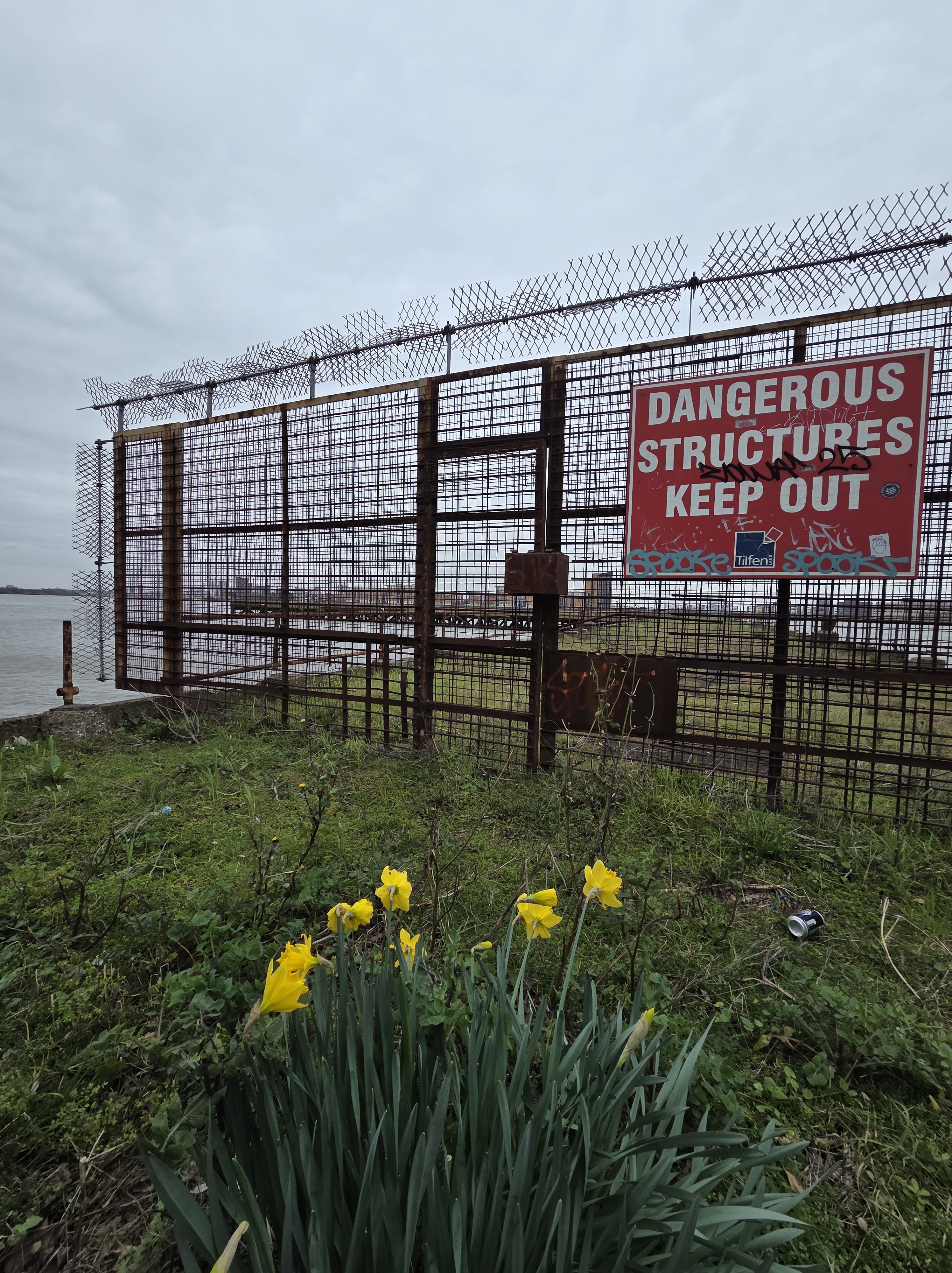
It had been a very urban walk until now, but the path now headed off around the Plumstead Marshes with a gravel path. It was nice to get off the pavement and onto paths that are kinder to my feet. However, it was short lived and the hard pavements returned after a few kilometres. The main reason for this is,the path is largely shared with National Cycle Network route 1 to Dover, I think. While the landward side of the walk had been urban, the seaward side had many opportunities for wildlife. Many of the disused, and really dangerous looking, piers and landings had started to return to nature and were covered with a variety of fauna. There were a lot of sea birds around, either floating in large groups or foraging on the surprisingly sandy beaches. One problem with the seaward side is, that the sea wall prevents you looking down onto the beaches. But when you can see them there is so much rubbish floating and being washed up on the foreshore. Its a bit depressing really. On a more positive note, there were numerous Cormorants in the water. After duck diving, they stay under water for such a long time I became concerned, but didn’t know whether to ring the RNLI, or the RSPB. To help reassure myself, I did some scientific research and they can stay under water between 55 and 65 seconds, so don’t ring anyone before this as you would just look stupid.


After the rural feel of the Plumstead Marshes, the path then reached Thamesmead, a huge area of housing right on the river front. I didn’t mind too much as it meant I was getting closer to something I was hoping would be a highlight of this walk. Crossness Sewage Treatment Works was looming on the horizon, with modern chimneys and tanks. The first thing I came to (behind a fence) was the Crossness Pumping Station. One of Joseph Bazalgette’s original 1860’s pumping stations when he introduced the London sewer system. Crossness is at the end of the Southern Outfall Sewer that serves the whole of south London, and the pumping station houses four massive steam beam engines that lifted the flow into the works. The buildings are quite spectacular, considering their purpose, but are looking a bit run down. I visited the pumping station many years ago, during an open houses event, and they were trying to get the beam engines running. I think they have now, and the signs say the next “steaming day” is Sunday 29th March 2026 – so that’s one Sunday sorted!


The path skirts right around the old Crossness buildings, and the newer buildings and tanks of the current works. It’s very interesting (to me) to be up close to some interesting bits of kit, and the complexity of the cabling is very impressive. A long with the sewage works, there seem to be a few incinerators along this stretch, including the sewage sludge incinerator (previously the sludge was just dumped into the North Sea) and what looks like two Power from Waste Incinerators/Power stations. As I was walking, I could see boats bring containers of waste to the plants, so they are probably in quite a good location rather than solely relying on road transport.


It had been a cold day, but as I rounded Ness Point, it seemed that I was getting the full force of the wind off the North Sea. It can’t have been as there are still some more “wiggles” on the Thames, but it certainly had a more coastal feel and there was a large ship coming towards me which reinforced the feeling. It was really run-down coming into Erith. Passing lots of industry, including two massively tall silos. Google tells me they may be soya beans or rapeseed. I can’t imagine the weight, or pressure, at the bottom of such a tall column of soya beans. They are intended for crushing for their oil, so perhaps half the job is done in the silo!


When I walked into Erith, I knew I had reached Kent due to the large number of Union Jacks and St George Flags. Living in Sussex I can always tell when we have crossed into Kent due to many more people flying flags (even before the current “patriotism” phase). I think they are just worried about the French invading. I walked to the Erith “Deep Water Port”, which looked like any other jetty, and headed off to the station.

I’m rather surprised how much I’ve written as it didn’t seem like much happened on the walk, but it just goes to show the benefits of writing about it afterwards. It had been dry all day, so once again I’d made the right decision, although it was raining as I walked home from the station, as it had been when I left this morning.


Thanks for all the photos. A lot of them are rather bleak aren’t they but interesting nonetheless. We can’t seem to stop building ugly edifices, and then decorate them with litter. Must be something about London that has a depressing effect on architects. Did it start with the Victorians? Still, Damien Hirst’s headless man fits right in.
‘foresightedness’ is indeed a word … ‘centre’ not ‘center’ – just saying …
LikeLike
Damn the US spell checker, I thought I’d been doing so well ;)
LikeLike
The comedian Linda Smith was born in Erith, a town she said ‘isn’t twinned with anywhere, but it does have a suicide pact with Dagenham’.
Roger “Northern Isles
LikeLike
Roger – I think she may have been right!
LikeLike