The spring equinox has arrived and as such the weather has turned colder. I left home for the first off-peak train in a gentle drizzle. The weather forecast doesn’t look too bad, with a couple of rain showers predicted during early afternoon. I decided to catch the High Speed train from St Pancras, mainly to save a bit of time as I had a plan to meet a friend for a beer later. This mean’t I was walking before 11 am, but had cost me about £12 more than necessary. I got off the train at Strood (the third week running I’ve been here) and walked down to the River Medway. The Black Widow submarine was still there, which isn’t a surprise seeing as it has been there for over 20 years, but to me is still a surprising sight. I walk across the bridge into Rochester. The road Bridge is quite fancy with turrets and arches at each end, but is overshadowed by the huge beams of the adjacent railway bridge. There are good views of the castle, which guards the river.


This week I was able to walk the whole length of Rochester High Street, it really does have some fine buildings. Last week I had scoped out the Pasty Shop, and treated myself to a Cornish Pasty and Chocolate Brownie. This should be more than adequate to carry me 30 kilometres. It was really hard to know what the weather was going to do but I decided to leave my coat(s) in my bag but get my gloves out as there was a really icy wind.


I decided to walk along the main roads towards Chatham. I did have a route going higher up behind the town but decieded that the old buildings looked interesting. The whole road seemed to be on two levels with a fence in between. Its really nice now as it creates a pedestrain route, but I can’t really envisage how it was orginally created. Were the houses first, was a row of buildings demolished – I’ve no idea.


I turned off before the modern Chatham High Street towards my first view of the river. Chatham looks like a bustling place with lots of new development going on and some very grand old buildings showing its previous history. I had to walked up a hill in the middle of the town, it seems like the first hill I’ve encountered in a while. This led past Fort Amherst, a Napoleonic era fort and a big statue to General Kitchener. I’d sort of forgotten my history about Kitchener, and a quick google reminded me of his military activities various parts of the globe. Interestingly, he died in 1916, when his ship, travelling between Scrabster in Scotland and Scarpa Flow in the Shetlands, was sunk by a German U boat. I don’t remember reading that in the Scarpa Flow Museum! A little further down the road is the very grand entrance to the Historic Dockyard, which is a museum open to the public.


After passing the very grand entrance, the route was very much like walking around the Portsmouth Dockyard, just walking between huge aging brickwalls. There is still clearly a fair amount of military activity in this area with what looks like an operating barracks on my right. Halfway down the hill, and still between the walls, I passed a plaque. It was hard to read (without stepping out in the road) but I did see it was in memory of some cadets in 1951. I made a mental note to look it up, thinking it may be about a terrorist bomb or something. It turns out it marks the spot of the terrible Gillingham Bus Disaster, where a group of 52 young cadets aged between 9 and 13, were marching in formation along the road to a boxing match on a winters evening, when a double-decker bus ploughed into them, killing 24 and injuring a further 18. The group, which had no lights, saw the bus coming head-on, which was only using sidelights, and moved to the side assuming the bus would see them. Unfortunately, the bus driver didn’t see them; him without headlights, and the cadets in dark military uniforms. The bus just ploughed into them. The driver was charged with dangerous driving, fined £20 and banned for three years (he avoided jail). This did result in many improvements; the council improved the street lighting across the Medway area, the bus company fitted a kerb side spotlights to buses and the military adopted carrying front and back lanterns for columns of men moving along roads at night. Apart from a coach crash which killed 35 people on board in 1975, this remains the worst road accident in the country. As a cyclist, this accident has many sobering elements, such as the driver was pretty much let off, this still seems to happen today. I often see cars with their “daytime driving lights” and no headlights at night, especially in urban areas and street lights are pretty poor. The most sobering thought is that, that the group presumed they could be seen by the bus, and essentially died because of that presumption (although I suspect in reality it may have been their commanding officer who made this presumption). As a cyclist, I’m always amazed at the numbers of other cyclists I see in dim conditions dressed in dark clothing, presuming that the motorist will see them. Seems a bit daft when you can easily wear something bright or reflective to increase your chances – make sure you can be seen out there!

A bit further down the road (I really should have taken more photographs so here is a Google Streetview link) are a series of placenames stuck to the old walls. Initially I thought they may be military campaigns, regiments or something like that. It turns out they are the bus stops for the thousands of workers that used to work on the Dockyard. It was good to get out from between the walls, and get a better view of the Historic Dockyard. I couldn’t see any of the ships that you can visit (it is open to the public) but the huge buildings certainly give a sense of scale to the operations that would have been there.

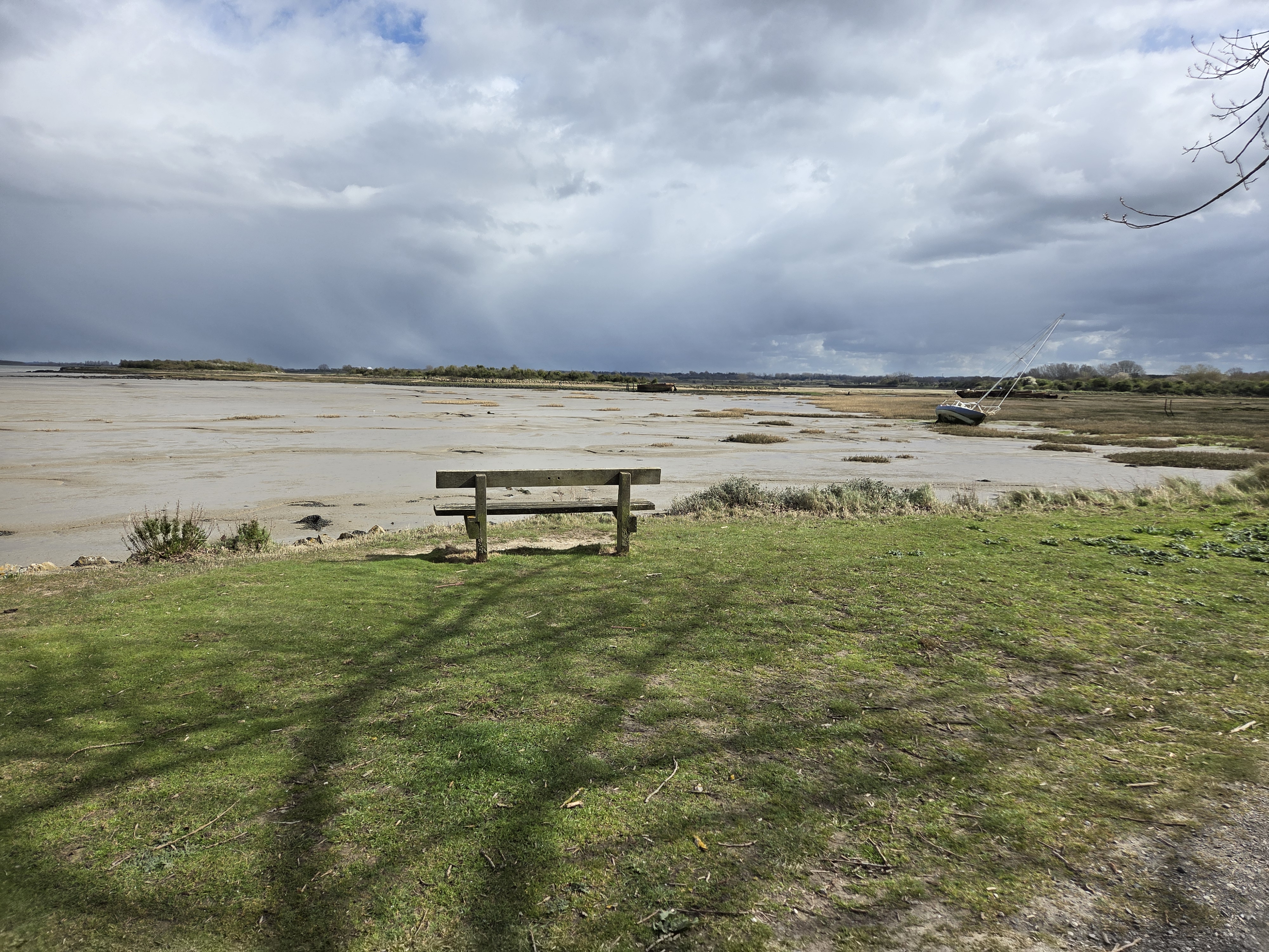
The path got a bit boring from here on, although it must be said it hadn’t been particularly enthralling up to here either, as it skirted between new housing estates and the River Medway. It wasn’t bad and the sun was out, it just wasn’t that interesting either. In fact it took me ages to realise that I had walked down the opposite bank last week, it didn’t look very familiar and I presumed there was an island in between my last route. There were some relics of the past left around, but essentially this part of the coast is fully redeveloped and providing lots of housing. It is a nice part of the world, with good transport links and plenty of ex-naval land so it seems ideal.


I must admit to taking a few short cuts, or rather planned deviations, away from the official coast path. Often it would just be directed from the main road, towards the shoreline through a completely modern development before being directed out to the main road again. This seemed a bit pointless so I focused on getting out of the urban area as quickly as I could.

Eventually I made it to The Strand on Gillingham Marshes, which felt like getting back to the coast. It also had a public toilet which was most appreciated, as I had forgotten to golden rule of a long journey before an urban walk, which is “make sure you go on the train!”. There were good views across the estuary towards the Isle of Grain and I could see all the power stations, tanks and big buildings I’d walked past on my previous walk. Although I couldn’t always seem them as the weather was very changeable and I could see mist and rain sweeping across the horizon, which may have restricted the view, but was also a sign of what might be coming my way.

The path returned to a nice rural path along the flood defences. I had been walking just in a jumper, but just before leaving the shelter of civilisation, I decided to switch my top layer for a waterproof jacket as the weather was looking a bit ominous and the wind was certainly getting up. After a few minutes I had added a woolly hat and gloves to my outfit, and was worried that my glasses might get blown off! It was good to be out in such fresh weather, and I even had a premonition and put my waterproof over-trousers on five minutes before getting hit by a hailstorm. It was so cold!
The weather squalls were short lived, and I soon got too hot in the waterproof trousers so had to jump around a bit trying to take them off. I took one slight wrong turning heading to something called Horrid Hill, which I rather assumed was on the coast, but turned out to be an isolated headland. There was another hill on the horizon, Motney Hill which I know of as it has a large sewage treatment works on it. While its not a massive hill, it is clearly above the sea level and would have stood out before the marshes around it were reclaimed. The Saxon Shore Way, long distance path, is still along this coast so presumably this does form part of the historic coastline.

After climbing (probably too strong a word) over Motney Hill, the view changed to a new inlet which was full of feeding birds. Some groups just ignored me, while in other groups, one bird would alarm and dozens would then follow suit. I felt a bit guilty disturbing them really. At this point another freezing hailstorm hit while I was walking along an exposed section, and trying to get my waterproof trousers on with nothing to hold onto was rather comic, especially when my boot went into the packing pouch rather than the leg hole. Somehow I didn’t fall over.

Once again the weather quickly returned to normal as the path cut inland. From this point forward I was walking through lots of (I suspect) apple orchards. Kent is known as the “Garden of England” and I think I have now walked far enough away from London to find it. The trees are just coming into bud and look ready to spring into action. Its amazing how small the trees have been pruned and trained, presumably to give a high yield of apples but to also make harvesting them easier. The amount of seasonal manpower required to pick the fruit was quite clear by the amount of temporary accommodation – portacabins, caravans and such like in various farmyards.


The final stretch was along the coast, but on the map I was still well within the natural harbour created by the River Medway and still a good distance from the actual Thames Estuary. However everything is so flat I could see Southend on the other side of the Estuary. I could also see The Sheppey Crossing, a quite fancy bridge that I would need to cross on the next stage of my walk to get back to the actual Thames Estuary at Sheerness. Sheerness is directly opposite, and less than 2 km from the Isle Of Grain, which I visited on my last walk and would take 2.5 days to get around to the opposite bank of the River Medway. This could be my longest “diversion” yet – it would be quicker by boat!

A feature of this section of coast was a number of small inlets and boatyards which seemed to have good numbers of Thames Sailing Barges moored in varying levels of deterioration or restoration. I think they can be called Thames Sailing Barges as they have “leeboards” which are keels on the side of the boat which can be lifted in shallow water, rather than a central keel, that would get grounded. As I approached Lower Halstow, my finishing point on the coast, there were some magnificent examples with full rigging. They must be so expensive to maintain, a real labour of love.


From Lower Halstow I had a three kilometre walk inland to Newington Station. As I left the village the footpath out was really obvious, clearly a well trodden path to the station. It was actually a very interesting path up and over some fields, through some woods and past a fishing lake. If I lived here, I could well imagine myself stumbling home along this path after a night out.

On the subject of a night out, one of the things that had kept me moving all day (apart from the hail storms and boring urban areas) was the promise of meeting a friend for a beer on the way home, in Croydon. We sat through the pub quiz (without entering) and pretty sure we would have won :) . I then staggered home through Burgess Hill after getting a late train home, it was slightly easier terrain than the route I had contemplated earlier.


