It was a bright, but pretty chilly morning as I headed up to the station, definitely below zero as I nearly slipped on the pavement 100m from home. I made a quick stop in Greggs for an emergency sandwich, unfortunately they didn’t have any, so I packed two emergency sausage rolls instead, ..and a bacon roll. I met a friend whilst walking to the station. She was off to work in Brighton and was envious of my walk. The trains were on time, and I got to Chichester by 10:30 and straight onto the 53 bus, which seemed to be waiting for me. There are two circular routes, the 52 and 53, and the 53 was the direct one to my start point. It was perfect, and I got an extra leg room seat by the emergency exit – I’m not joking! I was walking by 10:45, almost an hour earlier than last week, I think it is going to be a good day.

It took 10 minutes to get back to the coast, and the path then headed north (back towards Chichester). It was a beautiful still day and there was plenty of birdlife around. I could see people walking on a headland opposite and wondered whether it was somewhere I may pass through today. The coast is really wigglely here and it is hard to get your bearings. The map shows it as East Head and accessible from the Witterings, while a bit further along is Pilsea Island, which is off Thorney Island, which is one day ahead of me. If only I could swim across!

As the views expanded, Portsmouth became visible again across Hayling Island, but the peace and quiet was always disturbed by something. Initially, it seemed to be helicopters, then a barnstorming biplane doing lots of tricks. I got my big camera out and caught it doing a “loop the loop”. Eventually, it went away and peace was restored with only the occasional boat providing distraction.


Despite it being a pretty muddy path, the views were beautiful. I met a guy on a bike who asked whether I’d seen the “Russian geese”, (he qualified this statement with, the fact that the geese that had migrated from Russia and were not necessarily Russian) and were in front of the sailing club. I walked on with high hopes of seeing something something special. I like seeing and photographing birds but usually have no idea what species I’m seeing. Maybe this time!

Unfortunately, there was no bird life at all in front of Itchnor Sailing Club, so I’ve no idea what Russian geese look like. I would see plenty of Canadian geese later who were over here avoiding the 25% trade tariffs that Trump announced yesterday.


West Itchnor is a very pretty little village with (although I must admit to not noticing or remembering) a ferry. The ferry would have taken me to Bosham, saving me 16km of walking!!! Luckily, it only runs at weekends, and while I’m not adverse to ferries, taking this one would have missed out on some beautiful walking and views.

Most impressively, the route went through a private road, with some of the most magnificent houses I’ve seen. There was a real range of types of (huge) houses, and they were all very tasteful. I couldn’t help thinking that these must be the cheap ones, with a footpath going down the private road. Just having me walking outside, must knock a £million off the value!


The fancy houses were a feature of the walk from here, there really are some nice places around. I’d recommend this walk for anyone who is a bit nosey. The fancyness continued as after crossing the entrance to the Chichester Canal, the path got to Chichester Yacht Club. It is a vast expanse of yachts and boats, most of them on the water but plenty of them up on the land. It was interesting to see that there is a lot of potential for Yacht Valeting businesses. In all the excitement, I forgot to see whether I could take a short cut across their lock gates, and I think I added an extra 1.5km to the walk. It wasn’t all bad, as I had lunch (well, a cold Greggs sausage roll) in a really nice bird hide at the furthest point of the basin.

The path took me to Dell Quay, with a lovely looking pub on the slipway. It would be worth doing this walk a bit slower and stopping for a few pints, although I have promised myself a beer in Bosham near the end of the walk. Dell Quay is a more down to earth shipyard with all the boats lifted out of the water on a slipway. I think this is the place where my uncle Doug kept his boat. For many years he lovingly restored a wreck in his front garden in Staines, and when it was finished, he kept it here. I don’t think it was here long, when it was wrecked in the great storm of 1987. He went on to a more land based pastime of a being a publican in Priddy in Somerset. Writing this blog is a great opportunity to test my vague and poor memories with other family members. If this whole section disappears you will know the truth.

As I walked north, the sounds of civilisation gradually increased, I got a real feeling of leaving somewhere quite special behind. This area is trapped in its own ecosystem, somehow seeming remote but at the same time very close to Chichester. This probably explains the exclusiveness of the area and the big houses. The first indication of civilisation is Chichester Sewage Treatment works. This was the first treatment works I worked at during my career. I assisted in surveying the site, including measuring the “water” levels. In the inlet and screen room, I was really overcome by the terrible smells, and I had to walk around in the (relatively) fresh air outside for ages to reclaim control of my stomach! The guy I was with was very understanding and said I’d get used to it, and I did – the first one was the worst!

The path soon got to Fishbourne where two guys were just finishing building a bridge on the footpath over a small stream. I was declared “the first one” when I crossed and I’m fairly sure the bridge will be named after me. They were about to start lugging all the old bridge and their tools back along the footpath. I offered to help carry their gear back to the road, but they declined. I thought they might be volunteers (around my way the “Monday Group” maintain lots of paths and stiles), but were from West Sussex County Council. It was a long walk back to their vehicle, and would need quite a few trips through the mud. Tough work.


At this point I was only a few hundred metres from Fishbourne Station, so the pressure to finish was immense. However I pushed on heading south again around the next headland. Initially the route followed the coast, but eventually turned inland as there were no footpaths. There were a few sections along roads, which reminded me of walking in the Fens of Lincolnshire. Straight (boring) roads through flat lands, with ditches each side. Luckily, the roads were no more than 1 km long (unlike the +5km in the Fens) and I was rewarded with some more really fancy houses, including a Hofhaus (a favourite, which I didn’t photograph, but StreetView did!). Eventually, I turned south on a footpath to reach the point that the ferry for Itchnor could have brought me, saving 16km walking. I’m glad I walked. The footpath then followed right along the high water mark. I don’t think you could get through this way if the tide was in. It was a really nice walk on a firm gravel beach just above the water level. There had been absolutely no energy sapping shingle today, just a bit of mud, which can be tackled in an athletic manner puddle by puddle, rather than being dragged down by each shingle stride after shingle stride.

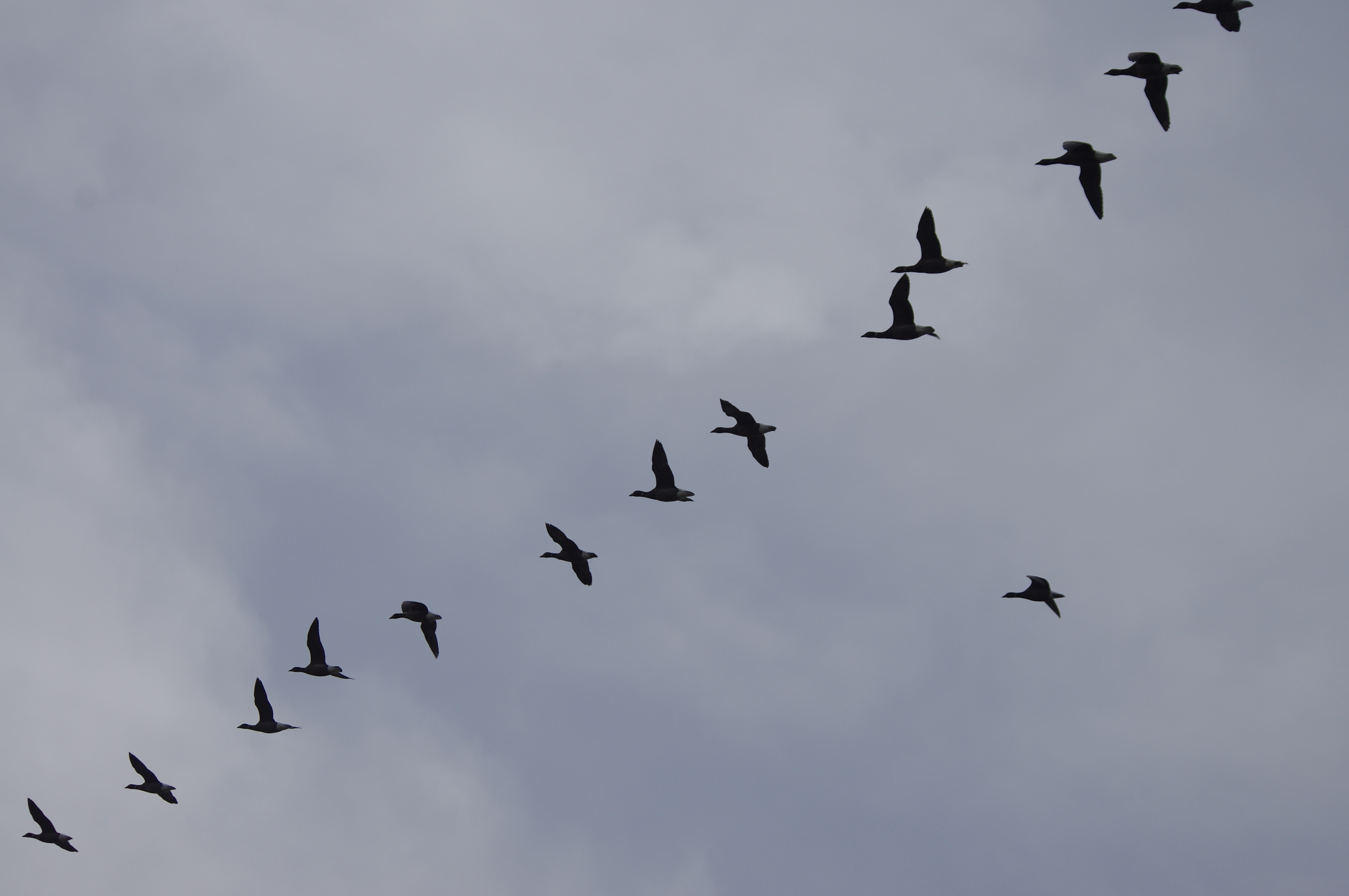
There was a lot of birdlife around, and I got my camera and telephoto lense out of my bag just in time to be treated to a goose flypast (I’m pretty sure they were Canadians not Russians). They were all arriving to feeding in the adjacent fields, there were hundreds of them.

Bosham (pronounced “Boz-um” not the “BOSH ham” I had been calling it) came into view. It is quite a big village set all along the water front with a big church setting it off nicely. At this point, there was a massive blast of geese noise, and they all started to fly around in huge flocks. It was quite a spectacle, and I had my camera at the ready.

Bosham is a magnificent village, with some incredibly old houses, and is clearly built right on the cusp of the land and the sea. Door flood barriers and step over walls to protect against flooding were everywhere. The road along the water front was already flooded by the incoming tide. Unfortunately, the pub was shut, being closed in the afternoon, and I didn’t think waiting around would be a good idea.


I walked past the church following the footpath signs, which were warning of “muddy path, low tide only”, to be met with the beach completely covered in water, and where it rounded the end of the sea wall looked to be very deep. I retraced my steps, and there was an inland route between the houses, which took me to more passable paths.

It was a short walk towards the A259 (coast road), which was becoming louder and louder. Initially I missed a turning off the footpath and had to turn back to find it. In reality, I think the footpath was closed (this was confirmed by signs at the other end) as the sea embankment had been breached. It was a bit of a scramble down, and back up again, made more difficult with tired legs and a stiff back from walking 30km, but I made it.

The path took me to the A259, where there was a nice wide footpath. Bosham station was slightly closer to the east, but I decided to walk to Nutbourne Station to the west. This was to knock off a good bit of road walking tonight rather than starting off on a busy road next time. I got to the station just in time to wait 55 minutes for the hourly train – absolutely perfect timing (not), but it had been a perfect day out.


