Firstly I’d like to apologise to those who have subscribed and get an email version of this. I’ve just subscribed myself and thought you would get a link, rather than a hard copy of my first draft, which is often terrible, and not a corrected version where I spot many glaring errors as soon as I press “publish”. If you can visit the Web version its often better, but really I must improve my proof reading skills (in my defence, these are written on a phone as soon as I can and I’m keen “to get it out there”, rather than wait around). Onto todays walk. The weather has got a bit more wintery since last week (I’m aiming to walk one coastal leg each week), and despite a slight threat of rain in the forecast, I headed off to Littlehampton. It’s a straight journey from Burgess Hill, so I just sat back for he ride. I’m trying to travel off-peak (with a rail card) where I can. This trip was an easy choice as even if I leave after 9 am, I could be walking by 10 – this made the £11.65 return fare (to Chichester) seem a real bargain. Looking at the train fares travelling west,they all look good value to a long way past Portsmouth (although I’d be starting later and later, but the days are getting longer and longer!).

It was a one minute walk from Littlehampton station to the coast path. I was greeted with a sightly less grey scene than I’d left a week earlier, although I think that can only be put down to it being slightly brighter in the morning light, rather than the dimness of the evening. As previously mentioned, I fear that my camera is taking exceptionally dull prictures, making everything look worse than it really is. In reality my camera isn’t as bad as I’d thought, and I’ll keep using it – as the convenince of taking quick snaps without taking my gloves off, and the zoom lense are a real advantage. If you can just keep in mind when reading the blog, not quite as bad as it looks!

On the subject of gloves, it was a day for being fully togged up. I started out with my down jacket and gloves, I was able to lose the jacket after a while, but the gloves stayed on all day. The pedestrian bridge over the River Arun was interesting as when you approach it from the town, it looks like it is a movable bridge (because it has gates and a control tower) but there is no obvious way it would swing or lift. The answer becomes apparent on the west bank, where the tracks show that it is a retractable bridge that is driven backwards to create a 3.4m opening. Subsquently, looking at the website, it can stay opened for quite some time, especially on very high tides, to allow a number of ship movements, but today the tide was low which would certianly prove advantagous for this leg of the coast (low tide was about 11:00).

The next part of the route followed the river back to the mouth, with the town and Funland on the other side. This was my first opportunity to walk on a bit of sand, which was nice. The path led up to car park and toilets, and then headed off on a boardwalk through the sand dunes. This didn’t last for long, and I soon found myself trudging through the shingle. Fortunately, with the low tide, I was able to get down onto the sand, which had dried out enough to allow easy walking. I suspect at high tide this section would be a real struggle in the shingle, although I have no real idea as you are quite isolated from the land, down on the beach level.


After a few kilometres I decided to leave the sand at Climping as I’d heard of a friend that “they’d ruined it”, and I needed to find out if this was true, and who “they” are. It was quite a climb up the shingle banks to get back to the coast path, but it was nice to reconnect to the land. In summary, it seems that Climping must be at serious risk of errosion from the sea and a huge embankment has been built between the beach front buildings (only some toilets and a caravan cafe) and the sea. I suspect it is to protect the few very old houses behind, but it does “ruin” Climping as a beach, and probably is a prediction for a lot of this section of coast. It is very flat,and I haven’t walked much above sea level since before Brighton. One hope is that there does seem to be an excess of shingle in this area (especially a bit further along in Bognor), so while this land is being threatened in one place, the sea is washing up new material pretty close by. This explains how the coastal works I have been seeing along my walk works, just moving shingle from one end of a beach to another. Although the signage for Climping Beach suggests it is not financially viable to protect, and the new bund has been posistioned to reduce flooding, and the beach will be left to “naturally function” or not.

Certainly the coast west from this point does look far less defended and one section that abuts farmland has certainly been left to the ravages of the sea.

After a short distance sea wall appeared again at Felpham, which isn’t surprising given the fancy houses in this area. There seems to be a new style of sea defence being used here, with “hammerhead” groynes made of rocks on the beach. This creates nice bays between each groyne, and the sand builds up behind it.

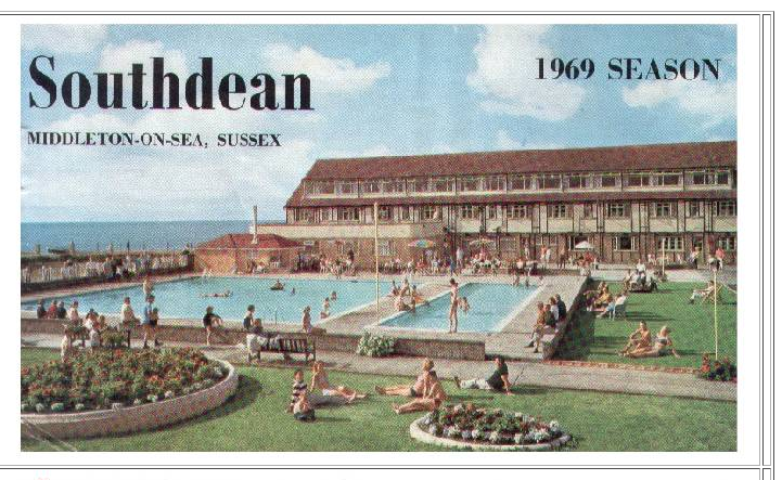
I was now in Middleton-on-sea. I used to come on holiday here as a very small child. I can vaguely remember coming to the South Coast Country Club (it sounds fancy but was a holiday camp). We came here a few times, but I’m not sure exactly when. I’ll have to ask my Dad, but somewhere around the late 60’s or early 70’s. Where the camp used to be is now a housing estate, with a couple of small blocks of flats facing the sea. I’ve looked on-line and there is quite a bit about the Holiday Camp including photos, and the programmes for a number of years. I can’t remember the “Beer and Pop Drinking Contest” on a Tueday lunchtime!!!


After more gruelling walking on shingle and passing lots of fancy houses, Bognor Regis was beginning to appear on the horizon, dominated by the big top tents of Butlins. This is the opposite end of the spectrum from the holiday camp I can remember as a child. Even walking along the seafont, I could hear an over amplified live version of “the wheels on the bus…” which gave me a flavour of the hell hole inside the high fencing. The joke always was that the fencing was to stop holidaymakers escaping – I’m not sure it’s a joke!

Bognor doesn’t seem to have all the trappings of the typical seaside towns that I had been coming across. The pier hardly leaves the shoreline, and apart from a few amusements on the pier, it just looks like a normal town. I decided to stop for lunch in the Dolphin Cafe and could not have chosen better. It is a real community hub, it seemed most people being regulars and being well looked after. A nice plate of ham, egg, and chips (true hiking food) and I was ready to hit the road again (with an emergency slice of cake in my pocket).


It was just a short walk out of the town centre until I met the dreaded private estates. Initially, this meant walking of the road, which I was easy walking, as the route turned onto the shingle, with no path. I did a scientific test, whereas normal walking (on mixed paths, roads, and a bit of shingle) I can average five to six kilometres an hour, on pure shingle this drops to well below four kilometres and is completely exhausting. Luckily, the tide was out, so I was able to get onto the sand and knock off a reasonable distance before it disappeared, or became too soft.

I had a short section of shingle before I got to one of the nicest bits of seaside development. Lots of small houses, some not more than converted caravans or sheds, with plenty of people around. I think people actually live in these houses, not like the vast “gin palaces” that I have been passing – I’m pretty sure they are all empty second homes. There are one or two fancy redevelopments occurring in the estate, so I’m sure its days are numbered. Anyway, these houses really marks the end of walking through urban areas, as the natural beauty of Pagham Harbour was ahead. I think the coast has been predominatly developed since Seaford, which is four days walking ago. The biggest gap where nature can reach the coast has been about a 4 km stretch, which was today.

Walking onto Pagham Harbour was glorious, despite it being an 8km route around the natural harbour to achieve less than 2km along the coast. The bird life was great, and I was treated to an aerial show as I arrived. The paths around Pagham Harbour are well used and there were plenty of birdwatchers out and about, together with the corresponding bird life. I took a few pictures, but given the “dullness” of my camera, I didn’t try too hard. I must get my big camera working and be prepared to lug it around.


About halfway around the harbour was a tiny village of Sidlesham Quay, with a pub (with accomodation). It looked like a brillant place to stay, or at least have a long pint. The tide was out, and the harbour is a series of tiny channels between scrubby vegetation. It would be nice to have a very long pint, or three, and see the tide come in. However, I needed to catch a bus tonight, and underneath the normal greyness, it was beginning to get dark.


The harbour path soon got onto the old Selsey Trackway, presumably a long lost railway line, which made for easy walking. The path got back to the coast an was soon entering Selsey. Many of the first buildings still retained evidence of their history, presumably starting life as old railway carriages conveted into seaside homes. For the ones I saw, I’m sure the retention of the past was only a token gesture, perhaps to get planning permission for any extensions.


After a bit more walking along the urban sea wall, I got to the lifeboat station and the bus stop (3 buses per hour to Chichester). I recalled from my youth that the Selsey Lifeboat was one that was housed in a boathouse on a pier in the sea, with a gangway to it. The current station is all onshore, with a huge boat mounted on a huge caterpillar tracked machine, that presumably can drive down, what looks like an incredibly steep shingle beach and launch the boat in the sea. Wikipedia tells me the orginal boathouse was demolished in 2017, and here is a clip of the last launch. The way the new lifeboat launches is not quite as spectacular (or quick), and I think it may be much more traumatic in rough weather conditions.

It was a 30 minute bus ride to Chichester Station, just in time for an eveing of train delays, due to a “road vehicle hitting a bridge” somewhere. It was a slow journey home, but it was nice to reflect upon a really nice day out, and more days of the same to come over the next few legs. I’d seen a few interesting “Blue Plaques” on route today, one for a members of Shackleton’s and Captian Scotts expeditions to the Antarctic, another for the composer of the music for Desert Island Discs, and a third (I didn’t photograph) for the construction of the “Mulbery Harbour” in the bay, before they were floated out for D-Day. The map shows one still stuck off shore, and I saw the rest on my trip to Arrowmanches last summer.


