I bet you thought I’d forgotten about the Greenwich Meridian Trail! I’m back to finish it. While I originally undertook it as training for trekking in Peru, circumstances prevented me from completing it before going. The first 160km certainly boosted my fitness, but its the remaining 250+km that represents the biggest challenge logistically as I get further from home. I’ve broken it down into a few multi-day stages, which will be good training for my next adventure!!! Before talking about my plans, just to catch up on Peru. I have a few draft posts to finish, I do find it difficult to write blog posts retrospectively as the spontaneity is lost, and it is a real chore – like writing a report for work! So they may appear later – I certainly want to write up flying over the Nasca Lines and share my thoughts about aliens!

Also before you think I have forgotten about cycling – which is the whole purpose of this blog. I haven’t done much, but I did cycle to (and more impressively, back from) a four day festival in Dorset with full load on my new bike. Which started with a 100mile ride (well – some were boats!) to the New Forest (and Camping at The Manor campsite – a cool place with composting toilets and everything! – see I did say I’d mention you).
https://www.facebook.com/campingatthemanor


I’m already writing too much, but I have time before the walk as I’m on the train to Chingford, on the northern outskirts of London. As I get further from home the travelling becomes more painful, so I’m doing about 70km over two days (to Royston which has a direct train home).
As avid readers, you won’t need reminding that Neil, a colleague from work, lives in Chingford, and that Chingford has a vibrant Essex Cafe Culture! So, capitalising on both these elements, I was meeting Neil for a coffee and he was joining me walking to the first landmark – Pole Hill. This would be in working hours for Neil, but as luck would have it, the company we work for re-branded yesterday to AtkinsRèlax – or something very similar, that means exactly the same ;). So it was important for him to take a break, have a coffee, have a brisk walk, and generally relax. Which we did. Pole Hill is very interesting, according to the plaque, the monument is true north from the Greenwich Royal Observatory (see my last GMT blog). So it was used to align the telescope. There is quite a view of London from the Hill but it is slightly obscured by trees.

I said goodbye to Neil at this point, and started walking in the wrong direction. We soon met up again when I turned around and he was walking back to a missed turning. Engineers and navigation!! I headed off through Epping Forest, it was glorious with morning sun coming through the trees and just a hint of autumn. There were glimpses of the world outside the forest, with large lakes (reservoirs) and distant views as the forest seems to keep to the higher ground.

The next point of interest was Gilwell Park, which if you don’t know is the HQ of the scouts. I have visited here once before, as a cub scout (so I would have been about 10) and can remember bits about the day there. I didn’t recognise anything, but thing “may” have changed in the intervening years. There were still some sights to see, with the original gate and a few old buildings.

The route continued across a golf course, the standard of playing was dreadful! The first thing I saw was a fairway drive 20 metres into a bunker, and generally there were lots of shouts of “four” and two balls ricochet in the trees above my head! It was a nice course with great views to the flatlands to the north, the direction I was heading.

Before descending, I wanted to take a very slight diversion to High Beech, and the Kings Oak Hotel. This was the location of the very first Speedway race/meeting to be held in the UK. A few riders came over from Australia in 1928 to show off this exciting sport. The Hotel looks the same, and I went in (to the Gastro Bar – which always sounds ominous to me!) but there was no memorabilia or anything to celebrate the numbers of people who flocked there 95 years ago. There might be something in the hotel itself. Anyway, I’ve nabbed some pictures from http://www.defunctspeedway.co.uk which give a flavour. Unfortunately more and more speedway tracks are being lost, including Wimbledon (Dons) and Eastbourne (Eagles) the two clubs I’ve supported, and including Rye House (Rockets) that I will walk past later today. Very sad! Anyway, I had a pint and a packet of crisps and I imagined what it must have been like – the anticipation of the crowd must have been crazy!


I dropped down the hill, and the steady drone of the M25 motorway started to fill the air. It was still a long way off and really grabbed my attention, so much that I walked through a field with the most vicious cows I’ve ever seen. Luckily they stayed at a distance, but I think I may have run if they moved as the horns looked really dangerous. I soon crossed the M25, which, while it is very noisy does provide a nice milestone of how far I’ve walked. The top of the M25 is a long way from Peacehaven.


Very shortly after, I reached Waltham Abbey. Which has a beautiful Abbey and a Greggs for my first food since a Chingford Croissant. The Abbey is really nice, and upon entry, I was greeted with “welcome back”, apparently I visited earlier that morning!!! When I denied it, the churchman satisfied himself by saying it must have been my brother, and walked off – spooky! The ceiling has the signs of the zodiac, which is unusual for a church (apparently).


I’ve seen quite a lot of “markers” on the Meridian Trail marking the actual Meridian line, they are often just plaques on walls, or brass plates in the pavement. So I was really pleased to see a really nice statue in Lee Valley, aptly called “Travel and Discovery”. Its in a brilliant location at the end of a long green avenue of grass and trees, and has been sculpted from two blocks from the old London Bridge demolished (or rather sold to a rich American, who thought he was buying Tower Bridge) in 1968.


I am writing a lot, but even though I am not halfway yet there is not too much to report in the second half. This is because the route goes into the Lee Valley and follows the canals for long distances. It’s a bit boring, and, I thought, hard to get lost. So I put my phone (map) in my rusac to recharge. After a couple of kilometres, I decided to stop and change into my shorts. By some fluke, I decided to photograph the location of this epic event and glanced at the map. I’d been walking on the wrong side of the canal, and was about to go dreadfully wrong. Instead, it was a short walk to a bridge and everything was good. Its very strange how these events occur just at the right time!
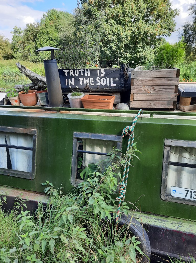

I carried on, on the tow paths. Along both the River Lee Navigation Canal and occasionally the River Lee its self. Even though there isn’t much to see, except canal boats, its important to keep reminding ones self that it’s flat, easy walking and a very direct route. So I should be more positive.

The last few miles to Ware was through big stoney fields which reminded me of the TV show, The Detectorists. I think 35 km to Ware was maybe slightly too far, as my feet were beginning to ache and I was getting stiffer and stiffer if I tried to sit down. I was spurred on by the though of staying in a pub, a few pints and a nice big meal with my boots off, and flip flops on. However, it was a nice pub, comfortable room but didn’t have any food. So after a recovery pint, it was boots back on for the “8 minute generally flat” walk down a big hill that Google said would be the source of food.

Ware is a nice little town. I opted for Fish n’Chips and even did a Tesco shop for supplies, including cushioned insoles. It was a slow hobble back to my accommodation up the, generally flat, big hill. The big question is can I do the same distance again tomorrow!?


